Showing posts with label Winter Hikes. Show all posts

Friday, February 10, 2012

Snowshoe Hiking on the Boggy Draw Trail

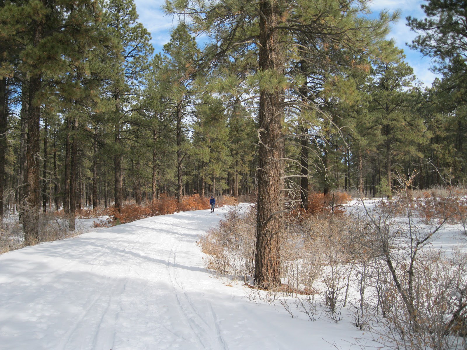
The Boggy Draw Trail system doesn’t receive any machine grooming for winter snowshoe hiking or cross country skiing, but the area provides a good winter experience in the tall Ponderosa Pine forest.


The Boggy Draw Trail System is in the San Juan National Forest about 3 miles west of Dolores in southwest Colorado. The trails are nested loops centered on Forest Road 527, an extension of County Road W. The central loop is known as the Boggy Draw Trail. The access road is cleared to a parking area at the trailhead and Forest Road 527 has a closed gate.

 I stayed on Forest Road 527 hiking with snow shoes. On the compacted route the walking relatively easy. Off of the compacted trail my steps were sinking in about 9 inches. The forest in this area is tall Ponderosa Pines with an understory of Gambel Oak. I noticed one tree close to the road that was marked with a small sign as a wildlife tree. I’ve noticed a few of these signs in the forest, usually on a dead snag.

I hiked along the Forest Road for about 0:45 minutes and turned around. This segment is mostly an alley through the tall pine forest with a couple of spots with views across meadows. My total hike took 1.5 hours for about 3 miles. It was a 35 F degree early February day. There were several other vehicles in the parking area and I saw several skiers while I was hiking.
;                     

Tuesday, January 31, 2012

McPhee Reservoir Snowshoeing

The McPhee Reservoir on the Dolores River is the second largest lake in Colorado. During the winter season when the water level is low, the north facing west end offers a broad slightly sloping area with an easy to access area for snowshoe hiking.

The access is about 4 miles west of Dolores, CO on Route 184, then north on the paved McPhee Recreation Area Road to the west end of the lake and the south side of the Great Cut Dike. There is room to park and a dirt road trail that leads to the shore line. This spot gets some use from bank fishermen during the summer months. On the west side of the Great Cut Dike is the pump house that sends irrigation water to the canals in the Montezuma Valley area.

The west end of the reservoir tends to freeze over sooner than the main channel area of the Dolores River. In the distance the San Miguel Mountains near Lizard Head Pass are visible. This area had a good snow layer for snowshoe hiking despite modest snow so far in 2012.

I spent part of my hike looking for animal tracks in the snow. I thought most of what I saw were coyote tracks in the area close to the vegetation near the high water mark. I didn’t see any water birds or any deer tracks, though deer are common in this area.

My total hike was for about 1:30 hours on a 44 F degree late January day. I hiked for about 1 mile east along the lake shore and returned. There is room to go much further than I did.

Monday, January 10, 2011

Boggy Draw Trails in Winter

The Boggy Draw Trail System is in the San Juan National Forest about 3 miles west of Dolores in southwest Colorado. The trails are nested loops centered on Forest Road 527, an extension of County Road W. The central loop is known as the Boggy Draw Trail.

The Boggy Draw Trails are open to bikes, horses, and hikers and cross country skiers and the special and very long Boggy Draw OHV Trail is open for motorized use. The access road is cleared to a parking area at the trailhead and Forest Road 527 has a closed gate. There are several options from the trail head area including both sides of the Boggy Draw Loop, the OHV Trail, Forest Road 527, and connections to the Bean Canyon Trail and Mavericks Trail not very far.

 I stayed on Forest Road 527 hiking with snow shoes. A snowmobile track made the walking relatively easy. Off of the compacted trail my steps were sinking in about 9 inches. The forest in this area is tall Ponderosa Pines with an understory of Gambel Oak. There aren’t many view points or specific points of interest that a snow shoe hiker could reach here, but on a blue sky day the green of the pines and the white of the deep snow make this a good outdoor experience.

I hiked for about 1.5 miles to the junction with Forest Road 527B in 0:45 minutes and turned around there. There is a small constructed pond at the junction. My total hike took 1.5 hours for about 3 miles. It was a 26 F degree early January day. There were five other vehicles in the parking area but I didn’t see any others while I was hiking.
                                 

Tuesday, December 28, 2010

Animas River Trail in Winter-Durango

The Animas River Trail is about seven miles of paved all season trail along the scenic Animas River in Durango, Colorado. The route began to take shape in the 1970s and continues to lengthen as the years go by.
I started my hike at the Santa Rita Park and hiked north. The Santa Rita Park is a short distance south of the junction of Highway 550 and Highway 160 on the west side of 550. This is an easy access if you are arriving in Durango from the west. There is a visitor information center at Santa Rita Park and also a Whitewater Park. During the summer months kayaks and rafts are frequently visible in this area.
 
There are many interpretive signs along the trail. North of Santa Rita is a view of Smelter Mountain and the site of the San Juan and New York Smelter that opened in 1882. The smelter closed in 1930, only to reopen during World War II for Uranium and Vanadium processing. All the buildings and tailings were removed by 1992. It is possible to hike to the top of Smelter Mountain from trails a little further south.

In 2011, the historic Durango Power Plant has been restored and converted into the Discovery Museum. The emphasis of the displays is hands on science activity for children, but the historic boiler room and examples of the historic machinery are also on dislplay.
The segment near the historic Main Street Bridge and Rotary Park has several interesting features. The trail crosses a bridge that is parallel to a Durango to Silverton rail line bridge and the Colorado Division of Wildlife has a facility just north of the bridge.

There is a short nature trail leading into the Wildlife facility which includes a hatchery for Cutthroat Trout. The nature trail has interpretive signs explaining the importance of riparian, or stream side habitat. There is also a display on Elk with an interpretive sign explaining the activity for each season.

In winter, the elk descend from the high country to lower elevation pastures, where they sometimes find traditional areas now covered with houses.

The Colorado Cutthroat is a true native of Colorado while the Rainbow Trout is an import from the Pacific Northwest. This display is only a short distance off the main trail.

There are several examples of public art along the Animas River Trail. The sunflower is just south of the parallel trail and railroad bridges. There is also a colorful Trout Wall art work south of the Main Street Bridge.
It took me 1:30 hours to arrive at the Durango Recreation Center, the north end of the west side trail branch. It is possible to go a little further north on the east side branch. My total hike took 3:10 hours including a lunch stop near the Durango to Silverton Train Station. I hiked for 7 or 8 miles on a sunny and mild 36 F late December day. There were many joggers and dog walkers and a few bike riders also enjoying the trail during my hike.


Sunday, January 10, 2010

Escalante Pueblo Trail in Winter

The Escalante Ruins Trail is the paved Interpretive Trail at the Anasazi Heritage Center near Dolores in southwest Colorado. In winter the1.0 mile round trip trail has been cleared of the heavy snow that makes most of the area trails difficult for normal hiking.

The Escalante Ruins site sits up on a hill overlooking the Big Bend of the Dolores River and the McPhee Reservoir. The Escalante Pueblo is thought to have been built in 1129 and is thought to reflect the building style of Chaco Canyon in New Mexico, even though Mesa Verde is clearly in view.

The Far View Sites Trail in Mesa Verde has pueblo sites that are similar in appearance to Escalante. The T shaped doorways in the surface rooms are found in both sites. The Escalante site is thought to have been remodeled three times, based on the ages of the wood used in the construction.

In winter conditions, the circular Kiva is of interest as this room would have offered the best shelter from the weeks of below freezing temperatures and several feet of snow such as we observe in mid winter now. At Escalante, the Kiva is surrounded by rectangular room blocks, similar to the arrangement at Far View.

In this region, water pipes are buried about 3.5 feet to prevent freezing, so the depth of the Kiva would offer similar protection. The ventilation system and arrangement for smoke to escape make it appear that warmth could be maintained. The interpretive information here indicates that the pottery found here was of the local Northern San Juan style rather than Chaco Canyon style and there are quite a few examples in the museum at the base of the hill. The smaller Dominguez Ruin near the museum entrance was completely covered with snow following a snowy December.

Wednesday, November 18, 2009

Ridge Point Lookout Trail-McPhee Reservoir

The Ridge Point Lookout Trail is the road in the McPhee Reservoir Recreation Area that leads to the campground, boat ramp and a lookout point. The McPhee Reservoir is Dolores River water in southwest Colorado, a little downstream of the town of Dolores.

In winter, when the normal trails are muddy or snow covered, the paved road provides a hard surface to hike on. The road may be closed to vehicles or it will have very little traffic. It is a 4.2 mile round trip to the lookout point, with the option to continue down to the lake by the boat ramp.

At the lookout point there is a concrete compass with interpretive signs identifying the geographical features around the 360 degree views. This is one of three easy to get to view points in this area. Nearby, the Anasazi Cultural Center Interpretive Trail ends at a good view point. The best view point in the area is at Park Point, the highest point in Mesa Verde National Park.

The views to the north and east include two of the nearby mountain ranges, the LaPlatas and the San Miguels with the reservoir in the foreground. The LaPlata Mountains had a lot of gold mining activity, mostly in LaPlata Canyon a little west of Durango.

Many of the trails in the San Miguels near Telluride still have ruins sites and ghost towns along the way. To the west the Abajo Mountains in Utah are visible. Below the view point is the site of the timber town of McPhee, which prospered in the early 1900s, but is now flooded. McPhee processed the Ponderosa Pines which dominate this part of the San Juan National Forest.

There is the short Can Do Trail running 0.5 miles from the nearby campground to the Lookout Point and then another 0.5 miles down the hillside to the boat ramp area. In winter, the trail will often be snow covered and muddy. The information sign says there is an Anasazi site about half way from Ridge Point to the campground.

This area had one of the largest archaeology projects in history, associated with the reservoir project. There are two excavated sites at the nearby Anasazi Heritage Center and several more on the same hill. This hike takes about 2:00 hours for 4.2 miles. I hiked it on a 45 F degree mid November day, a few days after an early winter storm.