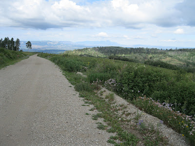
The Echo Basin area is about 3 miles east of Mancos, CO on Highway 160, then 7 miles north on Echo Basin Road. There is a meadow area near the junction of Forest Roads 566 and 331 that is rich in summer wildflowers. This is near the Ramparts Hill Loop Trail and is part of the area called T-Down Park, in the San Juan National Forest..
I started my hike about 0.5 miles past the Forest Road junction on Road 331 at a point where there is a cow trail leading uphill into the meadow. There isn’t a trail all the way to the top of the meadow. Mostly the walking is easy but there are a few brushy spots to push through.
The most common flowers in the lower part of the meadow appear to be Erigeron genus Daisies and blue Lupines in the Pea Family. My identifications are based on the Peterson Field Guide No. 14 and the swcoloradowildflowers.com web site, but I’m not an expert. Some of these flowers have many species that hybridize and are difficult to identify exactly.
I think this one is Yarrow, a member of the Composite Family and flowers from May to September. The elevation at my starting point is about 9200 feet and there is about 400 feet of climb to the top of the meadow.
There are some patches of False Hellebore in bloom in early August. This plant is also called Corn Lily. It needs sufficient moisture to produce a bloom.
I also saw this somewhat similar large Lily type plant but couldn’t find a name for it. Toward the upper part of the meadow I saw a few Geraniums and small patches of the bright red Indian Paintbrush.
Another red flower that occurred in small patches is this tubular one. I think this is a Penstemon in the Snapdragon Family. I also saw a few blue Penstemons.
Near the top of the meadow near Road 566 are many yellow Asters. My guess is that these are in the genus Packera.
Also near the road are many Balsamroots. These are visible filling whole fields near the Ramparts Hills.
At the top of the meadow is Road 566 which I followed back down hill for 0.5 miles to Road 331 and then 0.5 miles back to my starting point. Mesa Verde and Sleeping Ute Mt. are visible in the distance.


No comments:
Post a Comment