Showing posts with label Dolores River Upper. Show all posts

Thursday, August 2, 2012

Bear Creek Trail-Dolores River


The popular Bear Creek Trail begins about 22 miles northeast of Dolores along Highway 145 in southwest Colorado. The trail follows the Bear Creek southeast for 12.5 miles toward the LaPlata Mountains and connects to other trails in the area. The elevation at the trail head is 7900 feet.


The trailhead area is well marked. There are interpretive signs in the parking area discussing life in the Dolores Valley before the arrival of train transportation in 1891 and the unique features of Aspen trees.


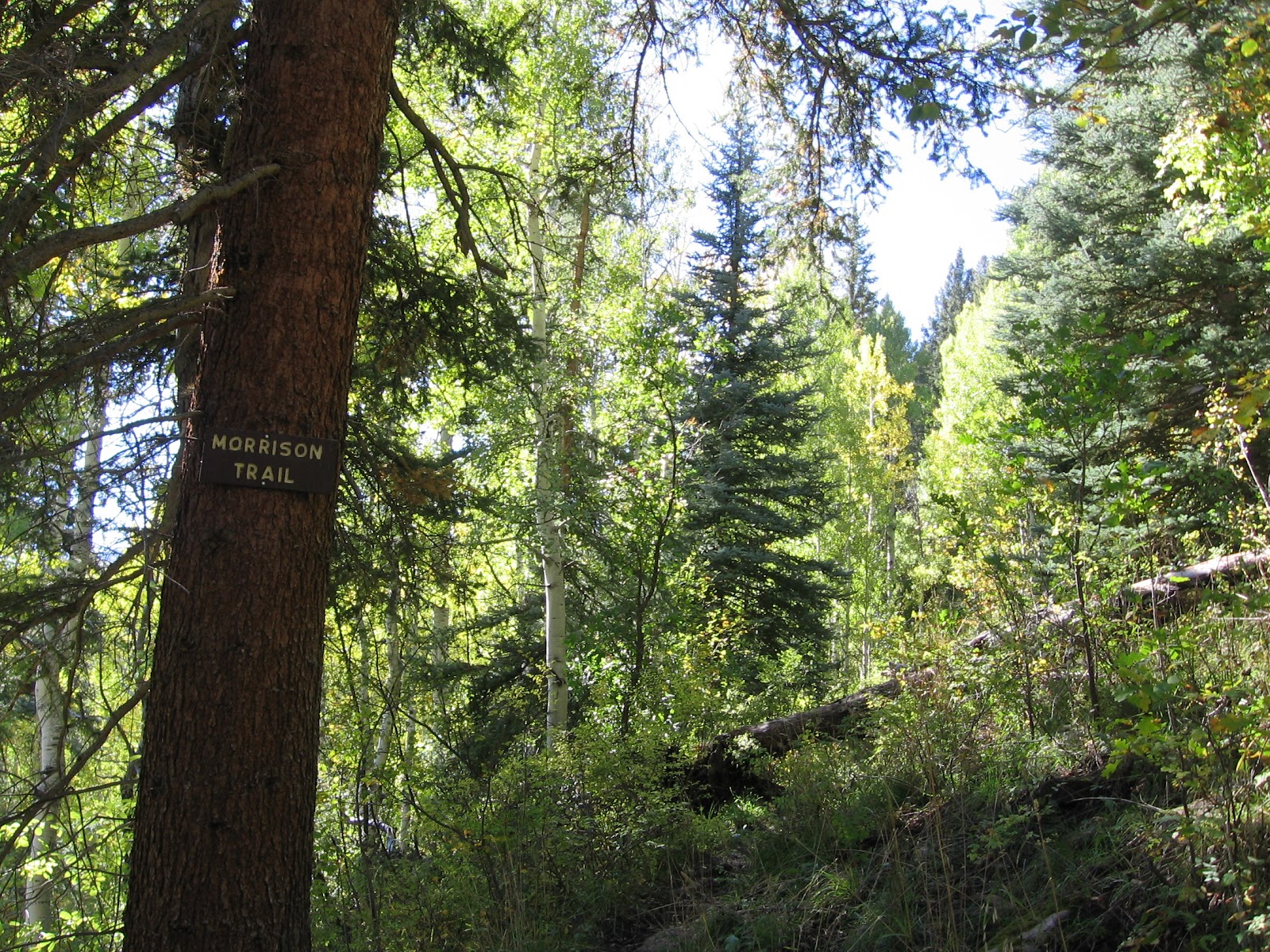
The first few steps of the trail cross the Dolores River on a footbridge. In the first ten minutes of hiking the route climbs steeply with switchbacks and the Morrison Trail branches off to the right, leading 8 miles to the Transfer Campground area. After 0.5 miles, there is the parallel Little Bear Pack Trail that re-connects with the main trail after 1.75 miles.


The trail alternates between being high on the valley side above the creek or right down along the bank. After the first segment of climbing, most of the trail is easy walking. The forest here is mostly tall spruce-fir and aspen trees, with a few towering Ponderosa pines in the sunnier areas. There are many Colorado Blue Spruce close to the Bear Creek and many Narrowleaf Cottonwoods.


After about 1:00 hour and 1.75 miles there is the largest of several meadow areas. Other meadows are visible on the other side of Bear Creek. Usually, marmots are visible in this meadow. Thistles were the main flower here in early August. I saw some of the hummingbird-like Hawk Moths hovering near the flower heads of the thistles. For the most part, the Bear Creek Trail isn't lush with wildflowers.


There are no glimpses of mountains along this trail, though the peaks are not far away. There are some good views across the deep canyon at the thick forest.
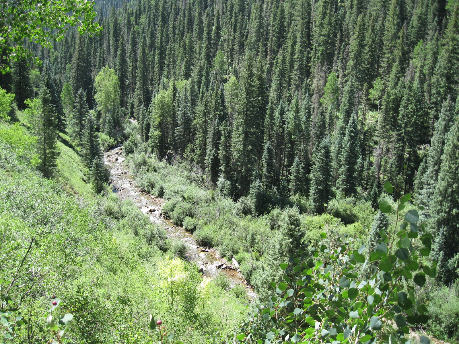

There are signs posted along the trail that say Fly Fishing only. Further up the trail, at the 6 mile mark, there is a junction with the Gold Run Trail where there has been work to restore Bear Creek and enhance the trout habitat.

I walked 4 miles to a trail junction at the Little Bear Creek, arriving after 2:20 hours. The crossing of Little Bear Creek is easy in August but during the spring runoff it would be dangerous. At this point to the left, there is the faint Little Bear Trail before the creek crossing that climbs steeply 2 miles to Hillside Drive. The elevation at Little Bear Creek is about 8600 feet.

My return hike took 2:10 hours for a total hike of 4:50 hours for 8 miles. It was 60 F degrees at 9:20 AM and 70 F at 2:10 PM on a sunny early August day. I carried and drank 3 liters of water. I saw 3 other hikers during my hike and there were several fishermen near the trailhead.


532497_120 x 90 Starting Salary $42k. Group 1 528614_Cool Camo Russell Outdoors

Friday, June 8, 2012

Priest Gulch Trail-Dolores River


The Priest Gulch Trail travels parallel to the south end of the Calico National Recreation Trail in the San Juan National Forest in southwest Colorado. The trailhead for both trails is on the west side of Highway 145 about 26 miles north of the town of Dolores. Priest Creek contributes to the flow of the Dolores River.


The Priest Gulch Trail is open to mountain bikes, horses, and motorcycles as well as hikers. It follows along Priest Creek while the Calico Trail climbs steeply to the east side mesa top. I saw many hiker and horse tracks but no tire tracks. The forest is mostly Fir and Spruce with Aspens. There are a few Ponderosa Pines near meadow areas. The trailhead elevation is 8050 feet and both trails climb as they head north.


After about 1.25 miles, there is a trail junction with a faint trail that connects with the Calico Trail to make a loop. In June 2012, the trail sign was missing but the pole was in place.


I looked at the crossing of Priest Creek and it would have been easy, but in heavy snow years early June might not be the best time to cross here. From here, the connection trail climbs steeply toward the Calico Trail.

Continuing on the Priest Gulch Trail, there are only a few places with any views. Most of the lower part of the trail is in deep but beautiful forest. The trail is well maintained and is easy walking as it climbs gradually. There is another connection with the Calico Trail after about 8 miles for a 16 mile loop. I went up trail for 1:50 hours, about 3.5 miles before returning the way I came. My total hike took 3:20 hours.


There were some minor wildflowers along the trail. The best were patches of Irises and there were many butterflies including large Tiger Swallowtails. I didn't see any large wildlife. My hike was on a 75 F degree early June day and I carried 3 liters of water. I saw two other hikers during my hike.


Sunday, April 18, 2010

Can Do Trail Ancestral Pueblo Ruins

The Can Do Trail leads 0.5 miles from the McPhee Recreation Complex mesa top campground to the Ridge Point Lookout then continues another 0.5 miles down the cliff face to the boat ramp area.


McPhee Reservoir is centered on the Big Bend of the Dolores River in southwest Colorado. I started at the Ridge Point Lookout and descended most of the way, stopping to avoid the mud from the last of the melting snow. 

The area to the right of the boat ramp is the site of the former busy lumber town of McPhee which from 1924 to 1948 was the busiest lumber town in Colorado. The best views on the Can Do Trail are along the segment that descends toward the boat ramp.


The mesa top segment was designed as a no barriers trail and has benches every 300 yards. The trail segment leading to the campground area has a bench that is close to the cliffs. This area of forest is mostly Pinon Pines and Utah Junipers. I noticed that most of the rocks along the trail are rounded, as if this area was once a stream bed. There are small patches of sagebrush interspersed among the forested areas.

Among the highlights of the Can Do Trail is a small Ancestral Pueblo ruins site. This site is in the trail segment between the campground and Ridge Point. There is an interpretive sign indicating that this site has a circular tower and several room blocks and dates from around 970 AD.

The circular tower is clear but the room blocks are mostly unexposed. The sign also says this site was visited by pot hunters before it was studied by archaeologists. I spent about 1:00 hour for about 2 miles on a 60 F degree mid April day.

Saturday, April 17, 2010

Dolores River Big Bend Trail

The Dolores River Big Bend Trail starts at the interpretive plaque at the east end of the Dolores Cemetery that is on the north side of the river a little downstream of the town of Dolores in southwest Colorado.  


The plaque mentions that in 1776 the Escalante Dominguez Spanish exploration party camped at the meadow site that became the community of Big Bend in 1881. When the narrow gauge railroad arrived in Dolores in 1891, the small but colorful town was abandoned.

In 1926 the logging town of McPhee was established nearby. McPhee was one of the busiest logging towns in Colorado until a disastrous fire in 1948 led it to be abandoned also. In recent years the McPhee Reservoir has flooded both sites, leaving the town of Dolores as the survivor of the early era.

The concrete base of the plaque has several historic artifacts embedded, including horseshoes, large spikes, a large key, an odd wrench and some cover plates. The trail to the mesa top to overlook the old sites starts at the back of the cemetery and climbs toward the very large boulder. At the mesa top are two large grassy fields separated by a side canyon. These two grassy areas are clearly visible from the lookout point at the top of the Anasazi Heritage Center Interpretive Trail high on the south side of the Big Bend.

                            
Arriving at the mesa top the walking is easy along the rim to view the McPhee Reservoir or across the grassy field. The eastern grassy field has more sage brush mixed in with grass than the western field.

                              
At the far end, look for old roads that lead down into the short but deep canyon at up the other side to the western field. The same road also leads higher but dead ends at a private ranch. This small side canyon and the cliffs facing the main river have some alcoves that look like possible ruins sites. I checked some of them, but didn’t see anything. There are good views over the Big Bend area, but only near the canyon rim.


The western grassy field had three rubble mounds that looked like small Indian Ruins sites to me. This seemed to be a favorable area with sunny exposure, wide fields for farming and the Dolores River down below. The moderately large Escalante Pueblo is directly across the river on the high hill and some of the shade structures on the hill top are visible. There is a lone Utah Juniper growing on a rubble mound that also looks like a small ruins site.

The three sites form a triangle and are about 250 yards apart. I didn’t see any pottery near the small sites, but saw quite a few shards on the eastern grassy mesa top where I didn’t see anything that looked like a ruins site. The western mesa also had the remains of an old corral and some sort of an old wheeled trailer.

Continuing west, there is an old road that descends west off the mesa down toward the banks of the reservoir. There is a sagebrush field area at the end of the road, and out toward a point there may also be a ruins site. All these sites are somewhat vague, but there are some small mounds and depressions and some brick shaped stones that don’t appear in other areas. My total hike overlooking the Big Bend area was 3:45 hours on a 55 F mid April day.
  528614_Russell Outdoor Logo 125x125

Friday, June 6, 2008

Oak Knolls and Dolores Canyon Vista Trail

The Oak Knolls Trail is an unofficial route off of the Boggy Draw Road 527 in the San Juan National Forest just west of Dolores in southwest Colorado.
 I started on unmaintained Forest Road 249 which is 9.4 miles north from the main trailhead of the Boggy Draw Trail System. There is a small reservoir near the junction of Road 249 and the Boggy Draw 527, and Road 249 continues north. The forest here is Ponderosa Pines and Aspens.

After a few minutes of hiking the Boggy Draw ATV trail crosses Road 249. The ATV route to the east is of interest as it leads to a point known as Canyon Vista, and there is also hiking to the west.

I skipped past the Canyon Vista trail and continued on. The forest changes from Ponderosa Pine to Oak, and there are some oak covered knolls. Wildflowers are good along this section of forest also, and there are a few views of the San Miguel and LaPlata mountains.

It took me one hour to get the Oak Knolls Reservoir, the distance appears to be about 2.7 miles. The reservoir looks like a good wetlands area, lots of aquatic plants and probably supports a few broods of ducks.

On the return hike I turned on an apparent ATV trail to the east. There is actually a loop route to the Canyon Vista point, though the trail head map only shows an in and out route. Coming from the north arm of the loop, it took 30 minutes to get to the Point where there are commanding views of the Dolores River Valley.

The Canyon Vista point overlooks the area where the West Fork of the Dolores flows into the main Dolores River. The return loop back to Road 249 took 20 minutes and my total hike to Oak Knolls with the Canyon Vista loop was 2:20.

The alternative route to the west I’ve called The Forest Restoration Trail. In this part of the forest there have been some efforts to restore the conditions that prevailed before settlement.

At the junction of the Canyon Vista Loop segment of the ATV trail turn left or west instead of right. This part of the forest is Ponderosa Pine with some patches of Aspens and an under story of Gambel Oak. After a few minutes the trail passes along the north side of the Boggy Draw Reservoir and I could see my car, so a shortcut is available here.

A little further there are some signs of timber operations, adding some interest. Among the listed goals of the Restoration Project is to provide products to the timber industry, but also reduce risk of catastrophic fires, reduce the risk of insect and disease outbreak, increase wildflowers and wildlife, and produce larger trees.

Foraging birds such as the mountain chickadee, red-breasted nuthatch, pygmy nuthatch and yellow-rumped warbler can help spur the growth of Ponderosa Pine trees in the West, according to a University of Colorado at Boulder study. The study showed birds removed various species of beetles, caterpillars, ants and aphids from tree branches, increasing the vigor of the trees.

Hiking through this area, I notice that some of the Ponderosas are marked with a slash of orange paint, which I think means these are the ones to be cut. The pine wood is highly desirable, light in weight, rather hard, strong, and relatively fine-grained. There are also small groups of cattle back in this area in summer. So as I recreate, I pass grazing, and timber operations in the multi-use area.

After about an hour of hiking there is a junction with another major power line and some views to the north toward Lone Cone Peak and slightly west to the Disappointment Valley. The ATV trail turns back to the south at this point. This segment of ATV trail has good views at both ends, here and at the east end overlooking the Dolores River Valley. After enjoying the views I returned to Boggy Draw Reservoir, using the short cut, for a total hike of about 1:40 hours.

Wednesday, May 7, 2008

River Trail in Dolores

The River Trail at Dolores, CO is about a one mile gravel trail that runs mostly along the river bank in the Town of Dolores, giving a close up view of the mountain stream just as it enters the McPhee Reservoir in southwest Colorado.

I started at the south end of the trail where the Dolores River passes under the Highway 145 bridge and the water is starting to back up from the reservoir.
The trail at the south end runs on top of the berm that provides flood protection. At this end or the trail you are in the Joe Rowell town park with softball and soccer fields, playgrounds and picnic areas just off the trail.
As the trail moves north there are fishing spots along the way with views of the ponderosa pines on the opposite side of the valley. The trail continues with a short section cutting through the neighborhood and ending near the library.

You can return along the same route or follow the main street back, visiting some of the small shops along the way. One highlights in town is the Galloping Goose, the old rail car that provided transportation in the area until the 1950s.

There is some interpretive information near the railroad museum also mentioning the Dominguez-Escalante Expedition, the first European explorers in the area. It took me about an hour to walk the full length and back, with a stop by the Goose.

Dolores River Story Walk  In June 2011, the pioneering idea of hiking exercise and family reading was put in place along a segment of the River Trail at Joe Rowell Park.  A series 13 small artistic signs were installed telling of how a young girl knows that the river lovers her. The Story Walk was developed by the San Juan Mountains Association.


I am here to visit one of my best friends in the world-the river. I know she loves me.

I know the river loves me because I can hear her calling me as soon as I am close.

She jumps and sings when she sees me.

I run to her side and she cools me down.

I know the river loves me because when I look into her face, she’s happy to see me.

When I jump on her back, she holds me up. When I leap into her arms she takes me in.


She tugs on my hair and arms and we flow together.

I watch her change like me. In the winter she is low and quiet. In the summer she is full and loud.

The river takes care of me, and I take care of the river. I only leave behind what already belongs to her.

I know the river loves me. The next time I come she will be here waiting for me, singing my name.

I know the river loves me, and I love the river.


Friday, November 16, 2007

Calico Trail-South Trailhead

The south end of the Calico National Recreation Trail in southwest Colorado climbs into the high forest country between the Dolores River valley and the West Fork of the Dolores valley.

The trail head is about 26 miles north of the town of Dolores on Highway 145. It is about 2 miles north of the Bear Creek Trailhead. The trail head elevation is 8050 feet.


The Priest Gulch Trail begins at the same trailhead. The Priest Gulch Trail follows Priest Creek and the Calico Trail  crosses the creek and starts climbing steeply.


As the trail climbs steeply, there is a good view of the Dolores River valley below. The trail head is across thehighway from a commercial campground. When you see travel trailers on the highways getting away from it all, they are headed for places where they can live under crowded trailer park conditions.

The forest here is lush, with Ponderosa pines, firs, and spruce, aspens, and good wildflower displays. I walked uphill steadily for 2:20 hours, maybe about four miles.

If I had made it to seven miles I would have come to the intersection with the Priest Gulch Trail and could have looped back. This trail appears to get a fair amount of horseback use. Horses seem to grind trails into a narrow shallow trench, so narrow that I have trouble walking on them.

There is another connection between the trails that I reached after 1:15 hours. I was going to take this route back so I could see both trails but I had trouble finding it, and then there was a bolt of lightning and the crash of thunder. Then it started to rain and I was at least 0:45 minutes from my car. If I had found the connection, it descends steeply and crosses Priest Creek about 2 miles from the trailhead.

I think the Calico Trail started as a route for sheep to get to the high pastures  there are remnants of old fences along the trail. The trail goes on for about 15 miles to the beautiful place called "The Meadows" at the foot of the San Miguel range of mountains in the Lizard Head Wilderness..

(There is a post on the north end of the Calico Trail in the Four Corners Hikes-Telluride blog. The north end of the trail has some of the most spectacular mountain views in the area.)


528614_Cool Camo Russell Outdoors

Morrison Trail at Bear Creek

The Morrison Trail starts at the popular and well marked Bear Creek Trailhead, about 25 miles north of the town of Dolores along Highway 145 and the Dolores River in southwest Colorado.


This is mostly a deep forest hike through thick Aspen and Spruce with a few Douglas Fir and Ponderosa Pine mixed in.


Rather than following Bear Creek up toward the La Plata Mountains, it crosses and climbs steeply up onto Haycamp Mesa.
 The forest is so thick it's hard to get any good views of the nearby mountains. But finally, up high there are good views to the north.


Down low, the trail passes by some old ranch buildings and the Aspens were starting to show some fall color.

I hiked for 2:30 uphill, and took 1:30 to come back down. There were no mileage markers on the trail,and I turned around at a random mud hole, but I think I went about eight miles total. The Morrison Trail continues on and crosses Lost Canyon and then ends at the Transfer Campgound area where it merges with the Chicken Creek Trail.

  528614_Russell Outdoor Logo 125x125 18407_$5 Shipping on Orders of $99 or More!