Sunday, July 24, 2011

Box Canyon Spur Trail-Echo Basin

The Box Canyon Trail has a west trailhead about 1 mile south of the Transfer Campground on Forest Road 561. The trail runs east for 6.5 miles to a junction with the West Mancos Trail in the vicinity of the old mountain town of Golconda. The Box Canyon Spur Trail provides an access to the eastern part of the main trail from the Echo Basin area.

The Echo Basin Road is a north turn off of Highway 160 about 3 miles east of Mancos in southwest Colorado. Forest Road 566 continues where the pavement ends. It is about 7 miles the junction of Forest Road 566 and Forest Road 331, in the area known as the T-Down Park and corral. The Box Canyon Spur Trail begins two miles north at the end of Forest Road 331.

The trail is a closed extension of Road 331. It is about 1.3 miles through Aspen and Spruce Fir forest to the unmarked junction with the main Box Canyon Trail. There is a small creek crossing along the way with some views to the west. I turned east toward the canyon rim that overlooks Deer Lick Creek. After a few minutes there are good views toward Mount Hesperus and the LaPlata Mountains.


At the canyon rim, there is a good view up the West Mancos River with the mountains in the background. The Golconda area is visible, old fences and trails, and trail signs. I had trouble with the next segment, both descending to and ascending from the Deer Lick Creek canyon bottom area.
 
The trail turns south and stays along the rim, passing some old fences. I was looking for a switchback that descended, but either I missed it, or the trail is very overgrown. I followed a trail that was descending, but it seemed to go too far to the south. Eventually, the trail I was following fizzled out, but I was close enough to the canyon bottom to see the canyon bottom trail, and I thought I was back on the right track.

There were several beaver dams along the Deer Lick Creek including beaver lodge. The wildflowers were also good along the creek segment. The flies and mosquitoes were a nuisance along here also.

At the junction of Deer Lick Creek and the West Mancos River, the Box Canyon Trail appears to cross and turn upstream toward Golconda. I didn’t cross, but in mid July the crossing looked easy. It took me 2:15 hours to arrive at the banks of the West Mancos.

On my return hike, I followed the trail back up the Deer Lick Creek until there was a muddy creek crossing and thought that I had gone past turnoff to the main trail that climbs out of the canyon. There appears to be an unofficial trail that follows Deer Lick Creek until it reaches Forest Road 566 near Lucy Halls Park.

I tried climbing to the canyon rim through the forest and found a closed road trail on the rim that also led to Lucy Halls Park. At Lucy Halls Park, there is a rock marked staging area that I think hunters use in the fall. There are also some good views toward the mountains.
 
From Lucy Halls Park I followed the Forest Roads 566 and 331 back to my starting point. The return hike on the accidental loop took 3:00 hours for a total hike of 5:15 hours for about 10 miles. On the return I cut through the wildflower rich T-Down Park.


Friday, July 8, 2011

Lower Hermosa Creek Trail

The Hermosa Creek Trail System in the San Juan National Forest has 14 designated trails that offer multi use opportunities for hikers, bikers, horses, and motorized. The South Hermosa Trail Head is about 10 miles north of Durango in southwest Colorado. Turn west from Highway 550 at County Road 201 just north of the bridge across Hermosa Creek and just south of a railroad crossing.

It is a few miles of paved county road and gravel Forest Road 576 to the well developed trail head area. There are campsites associated with the trail head and there are facilities for horse trailer parking. Hikers starting here can follow the Hermosa Creek Trail or the Jones Creek Trail.
 
I followed the Hermosa Creek Trail which follows high along the shoulder of Hermosa Creek. The forest at the start is Ponderosa Pines and Gambel Oaks with Spruce and Fir visible along the creek. The Hermosa Creek Trail doesn’t get any ATV use as it is too narrow. Mountain bikes and horses pass along here with hikers.
An interpretive sign at the trail head says that these are old growth Ponderosa Pines and there are some particularly large examples along the trail. I didn’t see any large wildlife but elk and black bears live in this area along with elusive bobcats and coyotes.
 
After a couple of miles there are some views across the canyon toward some of the peaks to the west. Aspen trees also start to appear. There are several small creeks that cross the trail.

 After about 3.7 miles there is a trail junction with the Dutch Creek Trail. The trail junction is clear but I didn’t see any trail signs. I stayed left on the Hermosa Creek Trail that descended about 500 feet of elevation in about 1 mile to a small bridge and a campsite area. It took me about 2:05 hours to arrive at the bridge and I turned around there.

My return hike took 2:15 hours for a total hike of 4:30 hours for about 9 miles. On the return there was a 15 minute sprinkle of summer rain. I carried and drank 3 liters of water on an 80 F degree day. During my hike I saw 4 bikers and 2 other hikers. There was a crew with 4 horses doing some spraying of noxious weeds.


528614_Russell Outdoor Logo 125x125 18407_$5 Shipping on Orders of $99 or More! 544544_$20 off any hotel booking of $350 or more with code TLSALE20

Saturday, July 2, 2011

Glade Guard Station Trail in Summer

The Glade is a wide and long meadow area in the western part of the San Juan National Forest in southwest Colorado. The hiking access that I used is about 15 miles north along Forest Road 504 from the Bradfield Recreation area on the lower Dolores River. At 14 miles the Forest Road passes the 50 acres Glade Lake, a good waterfowl bird watching site.


The Glade extends east and west for about 2 miles between Forest Roads 504 and 514. I think the mountain in the distance is called 
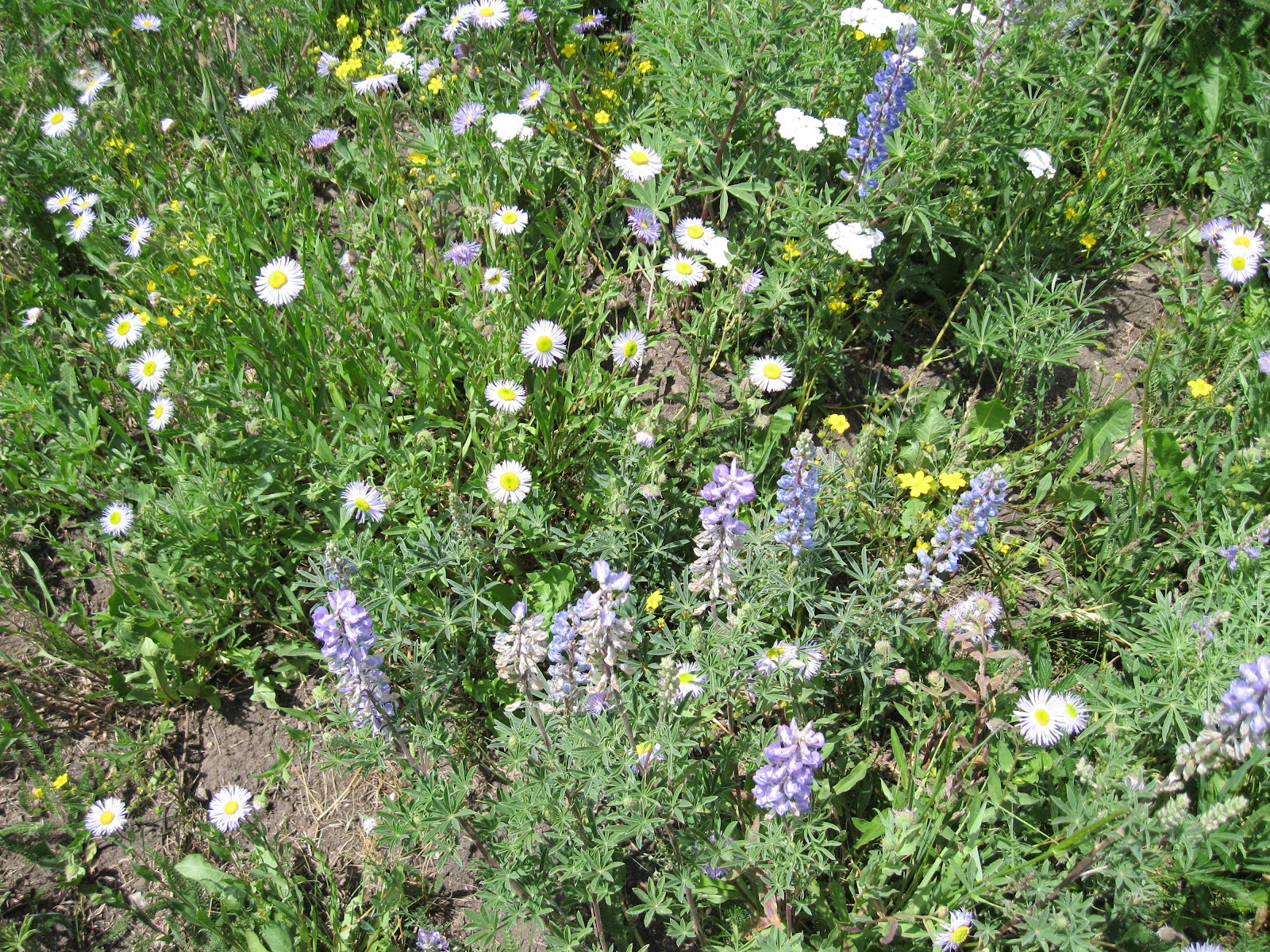
Glade Mountain. In the spring, there is a lot of water flowing through the Glade, but in early July the streams were dry. Besides Glade Lake, there are some other wetlands ponds in the area. There are a fair amount of wildflowers throughout the meadow area.


Besides the waterfowl at Glade Lake, I had the luck to see a small herd of Elk resting among the Ponderosa Pines along the north edge of the Glade. Most of the group was lounging in the shade. I might have missed seeing them if two of the group hadn’t ventured out into the open.

They retreated back into the forest when I got to within about 200 yards. From the distance I thought there were about 15 animals in the herd. Besides the Ponderosa Pines, this section of forest has many Aspens and Gamble Oaks.
 

Toward the east end of the Glade there is a Forest Road Junction of roads 514 and 497. At this junction the historic Glade Guard Station is visible.


The station was established in 1905 and was very isolated at the time. The existing structures were built in 1916 and the station continued to operate until the 1970s when it fell into disuse. There is a current volunteer project to restore the structures and make them available for public rental.

The main thrust of the restoration is to preserve the past, with former forest workers providing the momentum. I just observed from a distance, as it appeared that work was going on during my visit to the area.

 I explored into the forest in the area above the junction of 514 and 497. From here I could see one of the wetlands areas but didn't go over to it. Along a cow trail that followed a fence line I had a Black Bear sighting.


The bear stepped out of the brush and stood up for about 5 seconds, seemingly very calm. It then ducked back into the brush in an unhurried manner. Elk herds and Black Bear on the same hike is a rare double.


Besides the Glade, I did some hiking in the forest area between Glade Lake and the Glade. Compared to the spring, the water level is lower with a wider band of dark green wetlands vegetation. I just took a quick glance at Glade Lake, but I think I saw American Coots, Shovelers and Redhead ducks.
 

There are several fence lines in the area, usually with cow trails along them that a hiker can follow. My total hike was for 3:00 hours for about 6 miles. It was a 95 F degree day in the Cortez, CO area but comfortable in the forest. I carried and drank 2 liters of water.


544544_$20 off any hotel booking of $350 or more with code TLSALE20