Saturday, December 1, 2012

Rio Grande Southern Hotel in Dolores


The Rio Grande Southern Hotel and Restaurant was built in 1893 and is the oldest building in Dolores, Colorado. It was the first hotel in town and for many years was the only eating house between Durango and Telluride. It is located a short distance west off of Highway 145 on S. 5th St., in the vicinity of the Galloping Goose display and museum.


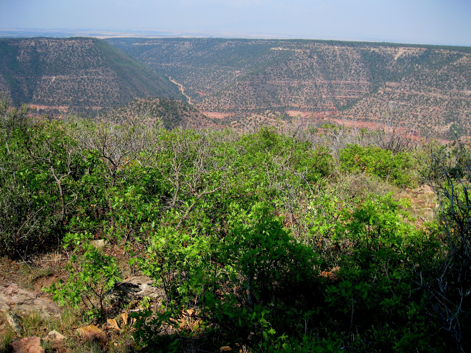
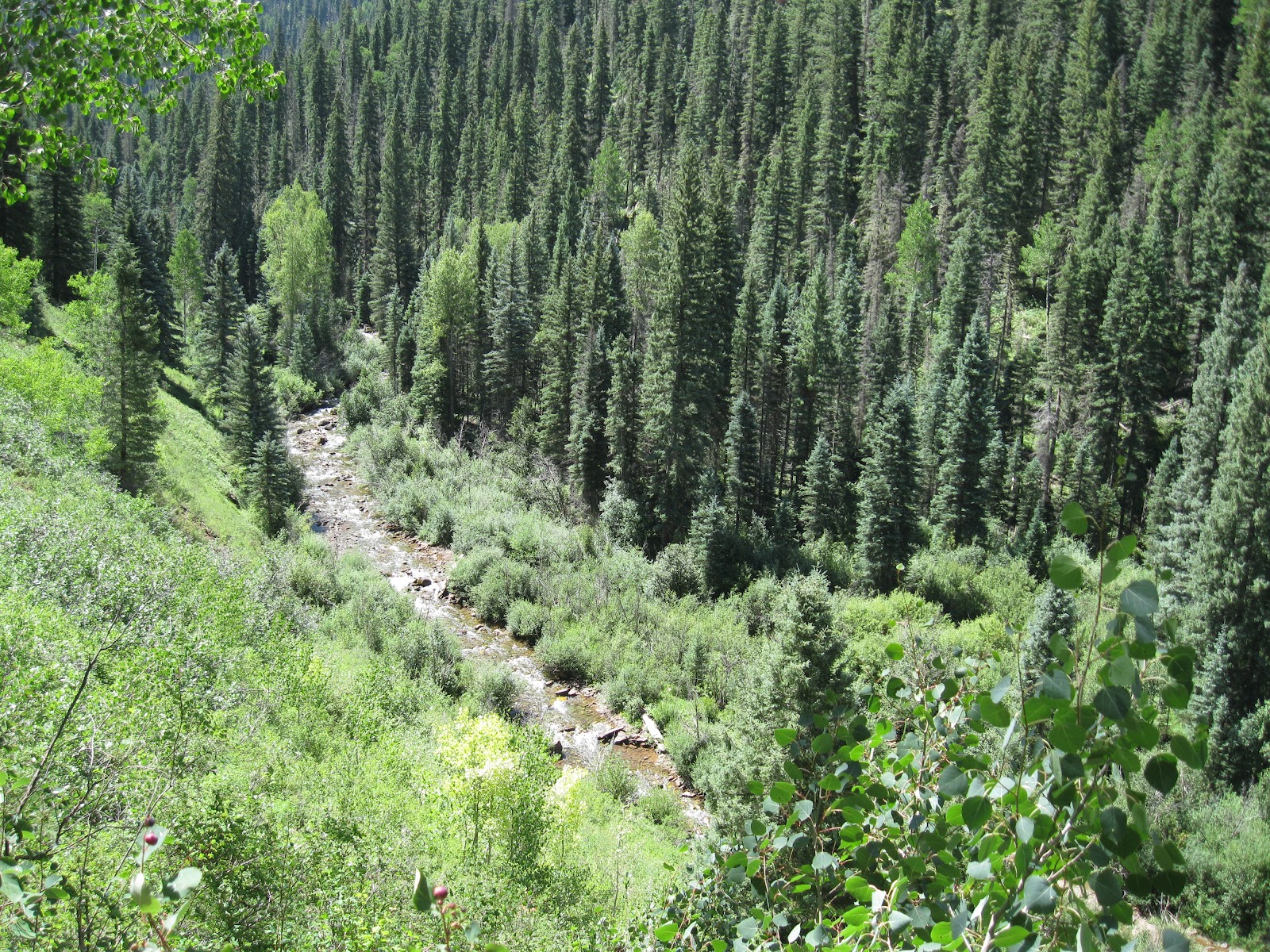
The Dolores area is a gateway for both canyon hikes and mountain hikes. Heading north along Highway 145 the Bear Creek and Priest Gulch trails are about 25 miles away. The west fork of the Dolores River also has interesting hikes at Fish Creek and the Geyser Springs among others.

Above Dolores is the Boggy Draw Trail System. The small but excellent Anasazi Heritage Center museum is a short distance away and it acts as the Visitor Center for the Canyons of the Ancients National Monument.


My visit to the Rio Grande Southern was following a view of the Galloping Goose Railway display and a short late fall walk on the Dolores River Trail. The Dolores Visitors Center along Highway 145 has copies of the menus of the Dolores restaurants. The interior of the Rio Grande Southern dining area reminded me of the similar era Historic Painted Desert Inn at Petrified Forest National Park. The Painted Desert Inn has been long retired and is preserved as an historic site, but the Rio Grande Southern Hotel is still operating.

The lunch menu at the Rio Grande Southern has a strong German flavor due to long time Dolores area chef Rita Bergestrom. On the shelf above the table where I ate there are copies of her “A Taste of Old Germany” cookbook for sale. I had a tasty Schnitzel sandwich with a side dish of German potato salad.

 I had to look up what exactly Schnitzel is and I found that it is a breaded boneless cutlet that is thinned with a hammer and fried. Schnitzel seems to be a style. The meat used can vary. I think my sandwich was pork but other meats can be used. The term Weiner Schnitzel is specific to veal.   There was a layer of lettuce and tomato with mayonnaise on the bottom and a layer of ham on top.


Sunday, October 7, 2012

Dolores River at Salter Canyon-Lone Dome


Salter Canyon is a north side canyon of the Dolores River in the Lone Dome Recreation Area in the San Juan National Forest in southwest Colorado. The Lone Dome Recreation Area is located 6 miles east of Pleasant View and includes the first 12 miles of Dolores River below the McPhee Dam.


I parked at the Ferris Canyon Campground which is open in the off season and is about 7 miles east along the Lone Dome Forest Road. Salter Canyon is about 0.4 miles further east. From the campground you can hike along the gravel Forest Road or along the banks of the Dolores River. There is a fence along the road with an easy gate near the mouth of Salter Canyon.


There is a wide creek bed with a bridge at the mouth of Salter Canyon. On the west side there is an unmarked trail that follows up the canyon. It looks like this trail was once a road but is now abandoned. The lower canyon has Ponderosa Pines and with thickets of Gambel Oak. There are also Rocky Mountain Junipers and Narrowleaf Cottonwoods along the creek.


The west side of the canyon has steep sandstone walls. I scanned the canyon walls for signs of ruins sites but didn't notice anything. The thickets of oak made it difficult to approach the canyon walls.


The trail was easy to follow for about 0:30 minutes or about 1 mile and then the forest became very thick and the trail overgrown. I saw one very large Ponderosa Pine near the upper end of my hike.


My hike in Salter Canyon was for about 1:00 hour with some additional time looking along the Dolores River. My total hike was for about 2:30 hours on a 70 F degree early October day. Other points of interest a little further east in this area include the old cabins that were the Lone Dome Ranger Station in 1912. There are also some old ranching structures in the same area.


Friday, October 5, 2012

Dolores River at House Creek


The House Creek Recreation Complex is a 65 site campground and 4 lane boat ramp site on the McPhee Reservoir of the Dolores River. This facility is in the San Juan National Forest in southwest Colorado. It is located 13 miles northwest of the town of Dolores using Forest Road 526 with a left turn on Forest Road 528.


House Creek is one of the flooded tributaries of the Dolores River about 5 miles upstream of the McPhee Dam. Before arriving at the Recreation Complex, there are 3 pull over bank fishing sites along House Creek with short trails leading toward the water.


There aren't any official hiking trails in the House Creek Complex, but there is room to walk along the shore and the park roads. In the fall, the McPhee Reservoir level may be low enough to expose Ancestral Pueblo ruins sites that were flooded by the reservoir project.


It looks like there is a ruins site on the cliffs near the mouth of the flooded House Creek. This site isn't very far below the high water line. I saw one piece of pottery associated with this circular pile of rubble.


Part of the exposed lake bed is easy to walk on and other parts are steep but with ledges. On the south end of the Complex there is a section of forest above the high water line.


In this forested area that would have had a high view of the Dolores River there is a vague rubble pile that could be a ruins site.


Associated with the rubble pile were several pottery shards and what looked like a set of grinding stones. There are some unofficial trails leading to this forest area from the group site at the south end of the complex. I continued a short distance further south to a flooded side canyon and then returned along the complex roadways. My total walk around the House Creek area took 2:00 hours on an early October day.


  528614_Russell Outdoor Logo 125x125

Tuesday, September 4, 2012

Haflin Creek Trail-Durango


The Haflin Creek Trail is a 5 mile route that climbs from the Animas River Valley floor up to Missionary Ridge, north of Durango in southwest Colorado. The trailhead is about 7 miles north of Durango along Highway 550, then east 1 mile on Trimble Lane and south 1.2 miles on County Road 250 to a gravel turn toward a Forest Service Work Center. I didn't notice a sign for the trail along the road. The Dalton Ranch Golf Course is in this area.


The first segment of trail climbs steeply with back and forth switchbacks above the trailhead area. There are increasingly higher views above the Animas River and southwest views toward Animas Mountain and the Hidden Valley area. The trailhead elevation is 6600 feet and there is 1000 feet of climbing before the trail starts to level off.


There are also good views to the north. The Haflin Creek Trail features a rich variety of trees. Gambel Oaks, Pinon Pines, Utah and Rocky Mountain Junipers, and Ponderosa Pines are all in view along the climbing segment. Further on are Douglas Firs and Aspens.


As the trail turns east along the north shoulder of Haflin Creek, the effects of the 2002 Missionary Ridge Fire become apparent. The Missionary Ridge Fire burned for 39 days beginning in June 2002. The burned area was measured at 73,000 acres and extended from here east to Vallecito Reservoir.

Ten years later, there are Gambel Oaks returning, but the tall pines and firs are scorched reminders. Baldy Mountain at about 9700 feet is the high point ahead.


The route continues to climb, but more gradually. There are two dry creek crossings and Haflin Creek has only a trickle of water. In early September, some fall color is starting to appear.


Further up the trail, young Aspens are growing. I turned around after 2:15 hours and about 4 miles at about 8500 feet elevation. There is a trail junction with the Missionary Ridge Trail about 1 mile further and 1100 feet higher.


My return hike took 1:45 hours for a total hike of 4:00 hours for about 8 miles. It was an 82 F degree early September day and I carried 3 liters of water. I saw 14 other hikers and 6 dogs during my hike.


Thursday, August 16, 2012

Dolores Canyon Overlook at Dove Creek


There is a marked turnoff for the Dolores Canyon Overlook on the south side of Dove Creek, along Highway 491 in southwest Colorado. From the turnoff it is 10.4 miles to the Overlook. There are BLM signs marking the way.


The Overlook is on a point of land high above an entrenched meander of the Dolores River downstream from the Bradfield Bridge area of the Lower Dolores River. There is a short trail out to a view point with picnic tables along the way. The Dolores River is visible on both the east and west sides of the view area. The elevation at the Overlook is about 8000 feet and the river is at about 6200 feet.


At the end of the trail there is a constructed view point. Directly north, the point of land visible is known as Mountain Sheep Point. Below, the Dolores River makes a sharp turn from north to south.


Flowing south for a short distance, it makes another sharp turn back to the north around Mountain Sheep Point. Below the south tip of Mountain Sheep Point, the access road from Dove Creek arrives at the canyon bottom where rafters can access the river and hikers and others can follow a rough road downstream for at least 12 miles.


There isn't an official trail along the canyon rims, but the terrain is open enough to allow some hiking. There may be the remains of an old road along the rim that cows now use. I walked for about 0:30 minutes south along the west rim. The road that descends into the Dolores Canyon to the river access
is visible across the canyon.


After 0:30 minutes south I turned east and it took 0:25 minutes to arrive at the east rim. The road is much closer to the east rim than the west rim. The terrain in between is Gambel Oak and Ponderosa Pines and was mostly easy walking. The only obstacle was the thicker patches of the oak. There is a fence to cross near the road. From the east rim I took 0:35 minutes to arrive back at the parking area. 


I thought these views and the terrain were similar to the Black Canyon of the Gunnison National Park near Montrose, Colorado. But despite the spectacular views, the Dolores Canyon Overlook is only an obscure site that is lightly visited.

On the road near the overlook I saw a Blue Grouse and I think I saw two coyotes sprinting across the road. There was a third animal about the same size as the coyotes but with a more lumbering gate. It wasn't large enough to be an adult bear, but may have been a young one. I just got a brief glimpse.  I spent 2:00 hours for about 3 miles of walking on my visit on a 75 F degree mid August day.


Friday, August 10, 2012

West Mancos Trail at Transfer Campground


The west trailhead of the West Mancos Trail begins at the Transfer Campground in the San Juan National Forest in southwest Colorado, near the town of Mancos. The Transfer Campground is a hub for the trail system in this part of the forest.

The full trail travels 10 miles to the Shark’s Tooth Trailhead. A good destination from Transfer Campground is the old mountain town of Golconda, 4.25 miles away.


The trailhead elevation is about 8900 feet. The trail descends steeply into the West Mancos canyon and heads upstream towards the LaPlata Mountains. After about 0.3 miles the Transfer Trail splits off to the right and travels downstream. 


The trail mostly stays well above the West Mancos River and goes through stands of Aspens and Gambel Oaks with Douglas Fir, Spruce, and Ponderosa Pine mixed in. The Aspens in this valley are particularly big in some places. Mostly the trail stays in deep forest without many view points.

There are many rocks along the trail that require careful stepping. After the initial steep descent the route has ups and downs but no more steep segments before Golconda. After about 0:40 minutes and 1.25 miles there is a view point from the top of a scree slope.


About 0:15 minutes further is Crystal Creek, the name shown on a sign. There is a log across the creek cut to form a primitive bridge that now appears to be cracked. In early August the creek was easy to cross without a bridge.


The West Mancos Canyon has many impressive cliffs but they are mostly obscured by the thick forest.


After about 3.6 miles there is a marked trail junction with an ATV spur trail that descends from the Aspen Loop Trail and allows ATV riders to travel to Golconda. The last 0.7 miles to Golconda is a two track trail with some open meadows and views of 13,232 ft. Mt. Hesperus.  Mt. Hesperus is one of the four mountains considered sacred by the Navajo Indians and marks the north boundary of their traditional area 


At Golconda, there are old fences to view along with more views toward the LaPlata Mountains. The Box Canyon Trail ends and is marked here. It is another of the Transfer Campground trails and takes a longer route to arrive here.

It took me 2:15 hours to arrive. The elevation of Golconda is about 9135 feet, higher than the Transfer Campground trailhead elevation even though the trail descended steeply at the beginning.


There is a large pile of boards that must be the ruins of Golconda. There isn’t any interpretive information here on what the history of this town was.

About 1 mile past Golconda the Owens Basin Trail splits off to the right with the West Mancos Trail staying left and climbing toward the Shark’s Tooth Trail. There is a shorter access to these eastern segments of trail from the Echo Basin area.


I chose to return using the ATV connector trail to climb to the Aspen Loop Trail. The climb is steep from 9135 ft. to about 9650 ft. where there is a good view point of this part of the LaPlatas with Owens Basin to the right.

The return along the Aspen Loop is easy walking and mostly downhill. My return hike took 2:00 hours for a total hike of 4:30 hours for 8.5 miles. It was a 75 F degree early August day and I carried and drank 3 liters of water. I saw 2 other hikers and 6 ATV riders during my hike.


532497_120 x 90 Starting Salary $42k. Group 1 18407_$5 Shipping on Orders of $99 or More! 528614_Cool Camo Russell Outdoors

Thursday, August 2, 2012

Bear Creek Trail-Dolores River


The popular Bear Creek Trail begins about 22 miles northeast of Dolores along Highway 145 in southwest Colorado. The trail follows the Bear Creek southeast for 12.5 miles toward the LaPlata Mountains and connects to other trails in the area. The elevation at the trail head is 7900 feet.


The trailhead area is well marked. There are interpretive signs in the parking area discussing life in the Dolores Valley before the arrival of train transportation in 1891 and the unique features of Aspen trees.


The first few steps of the trail cross the Dolores River on a footbridge. In the first ten minutes of hiking the route climbs steeply with switchbacks and the Morrison Trail branches off to the right, leading 8 miles to the Transfer Campground area. After 0.5 miles, there is the parallel Little Bear Pack Trail that re-connects with the main trail after 1.75 miles.


The trail alternates between being high on the valley side above the creek or right down along the bank. After the first segment of climbing, most of the trail is easy walking. The forest here is mostly tall spruce-fir and aspen trees, with a few towering Ponderosa pines in the sunnier areas. There are many Colorado Blue Spruce close to the Bear Creek and many Narrowleaf Cottonwoods.


After about 1:00 hour and 1.75 miles there is the largest of several meadow areas. Other meadows are visible on the other side of Bear Creek. Usually, marmots are visible in this meadow. Thistles were the main flower here in early August. I saw some of the hummingbird-like Hawk Moths hovering near the flower heads of the thistles. For the most part, the Bear Creek Trail isn't lush with wildflowers.


There are no glimpses of mountains along this trail, though the peaks are not far away. There are some good views across the deep canyon at the thick forest.


There are signs posted along the trail that say Fly Fishing only. Further up the trail, at the 6 mile mark, there is a junction with the Gold Run Trail where there has been work to restore Bear Creek and enhance the trout habitat.

I walked 4 miles to a trail junction at the Little Bear Creek, arriving after 2:20 hours. The crossing of Little Bear Creek is easy in August but during the spring runoff it would be dangerous. At this point to the left, there is the faint Little Bear Trail before the creek crossing that climbs steeply 2 miles to Hillside Drive. The elevation at Little Bear Creek is about 8600 feet.

My return hike took 2:10 hours for a total hike of 4:50 hours for 8 miles. It was 60 F degrees at 9:20 AM and 70 F at 2:10 PM on a sunny early August day. I carried and drank 3 liters of water. I saw 3 other hikers during my hike and there were several fishermen near the trailhead.


532497_120 x 90 Starting Salary $42k. Group 1 528614_Cool Camo Russell Outdoors

Tuesday, July 24, 2012

Dolores River at Slick Rock


Slick Rock is one of five boat launch sites along the lower Dolores River in southwest Colorado. It is 28 river miles below Dove Creek and 14 river miles above Big Gypsum Valley. On the road, it is 22 miles east of Dove Creek on Highway 141.


The Slick Rock site is the only one of the five launch sites that is on private property and there is a fee to park there. About 1 mile further east on Highway 141 there is a pull over point with an old road that descends to the river bank and provides about 1.3 miles of trail along the Dolores River. The area with the trail is on the BLM managed land.

This trail is slightly upstream of the boat launch point and travels further upstream. The Dolores River flows alongside Highway 141 from the trail down to the launch. The flow of the Lower Dolores River is controlled at the McPhee Dam about 60 river miles upstream.


During the time period that I hiked the water release had been steady at 70 cfs. During late July local showers could cause temporary increases in flow. I noticed that the flow 50 miles downstream at Bedrock was steady at about 52 cfs during my hike but shot up to 170 cfs later in the afternoon, before gradually decreasing.
The trail descends to cross a dry creek bed and then passes through a gate. A sign on the gate reminds visitors not to disturb archaeological resources. The Dolores River is very silty here after leaving the Dove Creek area still very clear. There appears to be a lot of willows along the bank but not much other riparian habitat. I checked the large boulders along the way for petroglyphs and kept an eye out for ruins sites but I didn't notice anything.


The east side of the Dolores River next to the trail is steep and rocky while the opposite side is grassy with mild slopes. There appears to be a trail on the other side of the river that continues further upstream. After about 1.3 miles and 0:35 minutes of hiking the trail fizzles out. My total hike took 1:10 hours for 2.6 miles on an 86 F degree late July day.