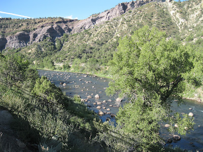
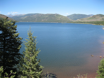
Vallecito Lake is located about 20 miles east of Durango in southwest Colorado. The Vallecito Dam on the Pine River was built in 1938-41 and created the 2720 acre Vallecito Lake.
The
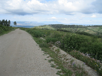
Vallecito Walk Path is a system of constructed trails and road side paths that allow a visitor to walk all around the lake. On the east side, along the Pine River, there are private campgrounds that appear to block vehicles from driving all the way around.
In 2011, the Bureau of Reclamation is charging a day use fee of $3 for use of lake facilities including the Walk Path, with self serve pay stations at convenient use points.
I started hiking at the west end of the dam. There is a small parking area with a restroom and the Walk Path is clearly marked. The top of the dam elevation is about 7673 feet. The normal depth of water is 121.5 feet.
This southwest segment trail follows closely along the shore for about 15 minutes, and then climbs up to the paved County Road to avoid private property. The road segment ends at the south Public Boat Ramp.
At the north end of the Boat Ramp parking area the Walk Path resumes as a trail and leads for about 2 miles to the north Boat Ramp. This segment is the most trail like though it is close to the County Road.
There are mostly unobstructed lake views with the mountains of the
Weminuche Wilderness coming into view. There are a few markers along this segment identifying some of the trees and plants. The south end of Vallecito Lake is dominated by Ponderosa Pine forest with a Gambel Oak understory.
There are a few Douglas Firs visible with Cottonwoods close to the shore. In early August there were some, but not many wildflowers along the Path.
On northwest side of Vallecito Lake, the artistic carvings become apparent with signs mentioning the
Carvings Tour. These are the work of a local artist and began following the 2002 Missionary Ridge Fire. There are at least 14 of these carvings a various points around the lake area. No. 6 is titled EMT and Eagle.
The Kaa-vi Nuu-ci Tuvu-pu
Mountain Ute Park is also in this area. This park was developed in 2007-09 and includes a wetlands area valuable to waterfowl. There is also a Trailhead for a hike to Lake Eileen with an interpretive sign for the Weminuche Wilderness. It took me about 2:30 hours of walking to arrive at the northwest side after about 6 miles.
At the northwest end, there is a county road leading north to the Vallecito Creek Trail. Continuing around the north lake area there are three creeks feeding into the lake. On the northeast side, the Middle Mountain Road leads north into the forest toward the Tuckerville Trail and Cave Basin Trail. The north end of the lake area is dominated by spruce trees.
Along the northeast side of Vallecito Lake, the commercial development is reduced and the paved road ends. Segments of the Walk Path resume where possible parallel to the Forest Road and there are good views across the lake.
South of the Middle Mountain Campground, the road seems to be blocked by privately owned commercial campgrounds, but I continued walking. At the Middle Mountain campground area, a forest road leads north to the Pine River Trailhead.
The southeast lake side has three Forest Service Campgrounds in a row and views are mostly obscured by the Ponderosa Pine forest. As the road approaches the east side of the dam, the views open up.
There are two interpretive signs along the road that describe how
Ospreys responded to the 2002 Missionary Ridge Fire and how the fire affected the
fishing in the area. Despite flames licking at their nesting trees the Ospreys persevered and fledged their nests.
The fishing was much affected by mud slides following the fires. Several thousand Kokanee Salmon were forced toward the surface to find oxygen and died of heat stress.
It took me 5:40 hours to walk all the way around Vallecito Lake, about 13 miles. I carried and drank 3 liters of water on a sunny early August day.


