Wednesday, August 20, 2008

Goble Trail

The Goble Trail is a 3.5 mile loop trail that climbs out of the West Fork of the Dolores River Valley up toward Nipple Mountain in the San Juan National Forest in southwest Colorado.
The trail head is about 10 miles north along paved West Fork forest road 535 and about 22 miles total north of the town of Dolores. There are a lot of trout fishing spots along the road here.

The lower part of the trail climbs along a small creek for about 15 minutes before reaching the loop. The forest along the creek is thick and mixed with Aspens, Engelmann Spruce, Douglas Fir, and Narrow Leaf Cottonwoods.

. This trail appears to get some use by horse riders, probably not very much from mountain bikers.
I took about 0:50 minutes of fairly steep climbing to get to the high point of the trail where the forest opened up into a meadow area and there were views of Nipple Mountain to the west topping out at 9763 feet. There is an old corral up on top along the trail and signs of cattle.


There are also views across the West Fork Valley to Stoner Mesa but no views to the mountains in the nearby Lizard Head Wilderness. The trail is a little confusing in this area as cow trails lead off in different directions. 

There are signs to help keep hikers on the trail but you have to keep an eye out for them and keep in mind that you want to loop back down to the east.


The south loop as I descended is a little more open and drier forest than the north side of the loop. There were ponderosa Pines in the higher area of this route. In mid August 2008 there were a few wildflowers along the trail but nothing spectacular. The lush mix of trees along the creek was more interesting than the flowers. It took about 1:40 hours to walk this loop trail.


Tuesday, August 12, 2008

Lower Stoner Mesa Trail

The Lower Stoner Mesa Trail starts at the Emerson Trail Head along the West Fork of the Dolores River in the San Juan National Forest in southwest Colorado.


The West Fork enters the Dolores River about 15 miles north of the town of Dolores. This trail is part of a 25 mile loop trail for mountain bikers that includes the paved road.

Dirt bikes and horses can also use this trail. The Emerson Trail Head area used to be a campground, but has been retired for camping for the last 10 years or so.
For hikers, the first part of the hike is along the bank of the West Fork River, then crossing a small bridge. Along the clear running stream are some tall Engelmann Spruce trees.

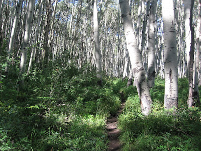
This is a good aerobic trail, climbing steeply with switchbacks through a mostly Aspen forest. The under story of vegetation is very thick and has a lot of waist high wildflowers. This route is like a narrow alley with chest high vegetation with shady Aspens overhead.


The views through the thick forest are across the narrow West Fork canyon with glimpses of the paved road below and a little up the canyon to the north. After the first 75 percent of the climb, the trail levels out for about 10 minutes. There are scattered Douglas Firs and Gambel Oaks high up.

The trail climbs more than 1200 feet and enters a high meadow area. A short distance across the meadow is a small constructed reservoir.

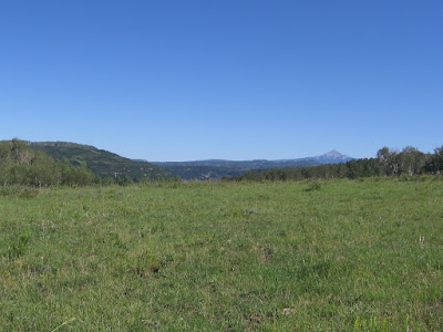
From the high meadow area there are views to Lone Cone Peak to the north and Mt. Hesperus back to the southeast. The trail continues on through a forested and meadow area.

It took me about 1:20 hours to get to the reservoir and I turned around there. My total hike was 2:30 hours.


Sunday, August 10, 2008

Dolores River at Cabin Canyon and the Bradfield Bridge

The Riverside Trail is a short paved no barriers trail in the Cabin Canyon Campground in the Lone Dome Recreation Area of the Dolores River. This is about eight miles below the McPhee Dam in the San Juan National Forest in southwest Colorado, and four miles above the Bradfield Bridge.


The Dolores River below the McPhee Dam is a good trout fishing area with very little development. The gravel road has numerous turnoffs with river access and there are two campgrounds. The Cabin Canyon campground has the unusual feature of a paved 2200 foot trail with benches, picnic tables and a fishing deck suitable for handicap use.
The trail runs close to the bank of the Dolores River through the lush riparian habitat of willows and cottonwoods. This is the kind of trail that is usually seen in the middle of river towns like Durango and nearby Dolores.
The gateway to the Dolores River downstream of the McPhee Dam is the Bradfield Bridge. The bridge is on the site of the Bradfield Homestead which operated as a big valley cattle ranch from 1900 until about 1978. In this area cattle herds would cross the Dolores River and head up to summer pasture in the high country of what is now the San Juan National Forest.

This area is a transition from the mountains to the east to the canyon country in the west. The main scenic values of the Dolores River area downstream are geologic, steep canyons with layers of exposed rock.


From this put in site there are about 97 miles of river to float, through the Snaggletooth Rapids, past the Gypsum Valley, to a spot named Bedrock. The first section from Bradfield, to the Dove Creek Pump Station is suitable for canoes.

Near the Bradfield Campground area, there are two odd looking structures. There is an interpretive sign that describes these as derricks, or cable stackers. Using horses and cables, these were used to lift bales of hay into stacks. These devices were used until about 1940, when they gave way to mechanized hay balers.

Besides the Recreation Site there is the Lone Dome Wildlife Area where there is 2 miles of hiking up and down the river on a dirt road, giving some views of the river, the Dolores Canyon and the old Bradfield Ranch site.