Thursday, August 16, 2012

Dolores Canyon Overlook at Dove Creek


There is a marked turnoff for the Dolores Canyon Overlook on the south side of Dove Creek, along Highway 491 in southwest Colorado. From the turnoff it is 10.4 miles to the Overlook. There are BLM signs marking the way.


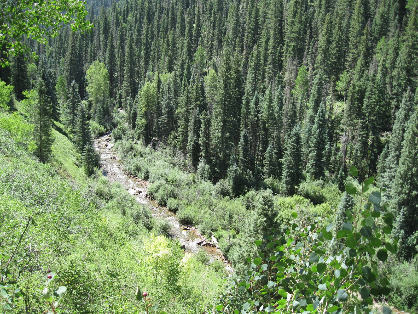
The Overlook is on a point of land high above an entrenched meander of the Dolores River downstream from the Bradfield Bridge area of the Lower Dolores River. There is a short trail out to a view point with picnic tables along the way. The Dolores River is visible on both the east and west sides of the view area. The elevation at the Overlook is about 8000 feet and the river is at about 6200 feet.


At the end of the trail there is a constructed view point. Directly north, the point of land visible is known as Mountain Sheep Point. Below, the Dolores River makes a sharp turn from north to south.


Flowing south for a short distance, it makes another sharp turn back to the north around Mountain Sheep Point. Below the south tip of Mountain Sheep Point, the access road from Dove Creek arrives at the canyon bottom where rafters can access the river and hikers and others can follow a rough road downstream for at least 12 miles.


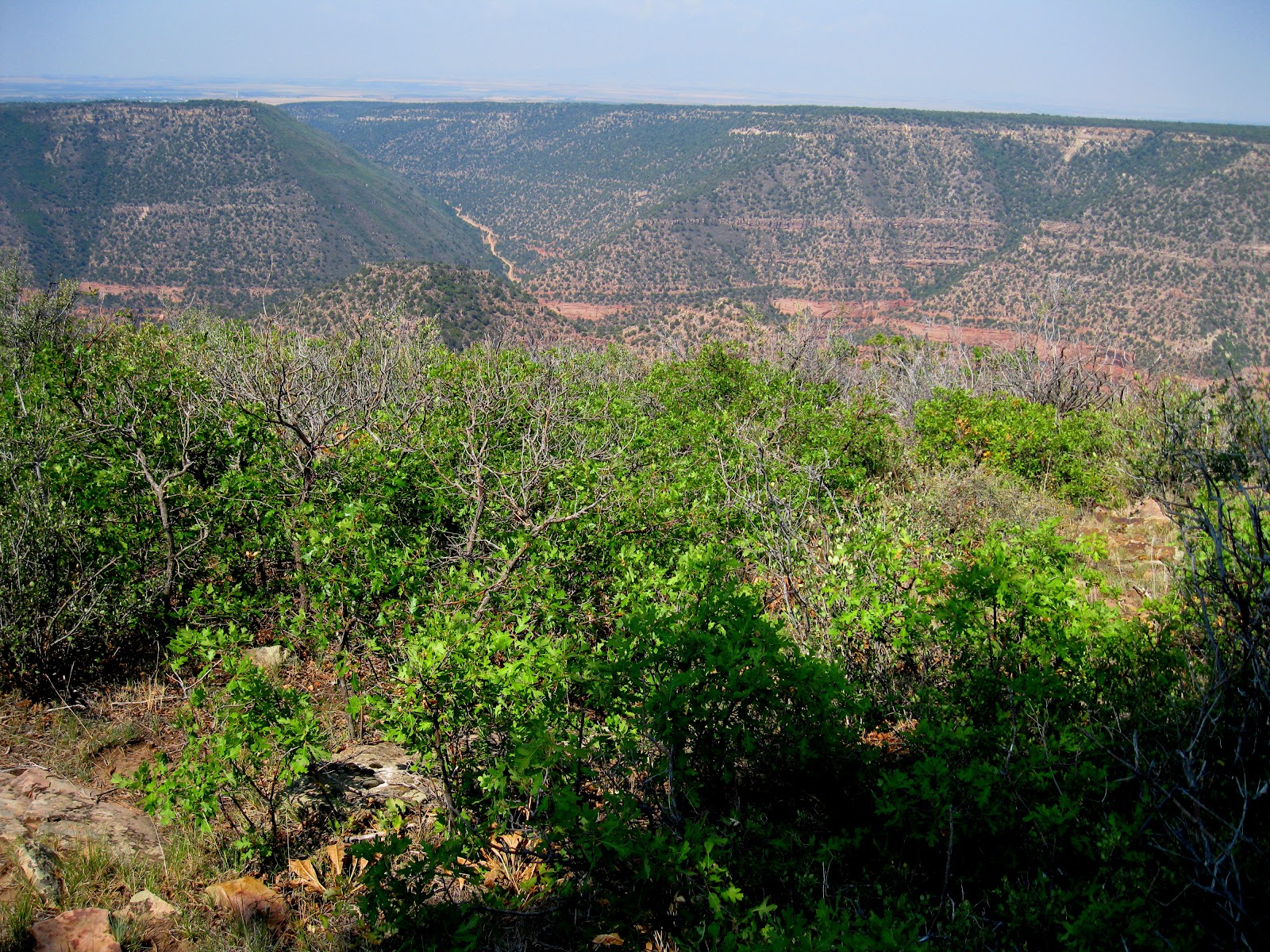
There isn't an official trail along the canyon rims, but the terrain is open enough to allow some hiking. There may be the remains of an old road along the rim that cows now use. I walked for about 0:30 minutes south along the west rim. The road that descends into the Dolores Canyon to the river access
is visible across the canyon.


After 0:30 minutes south I turned east and it took 0:25 minutes to arrive at the east rim. The road is much closer to the east rim than the west rim. The terrain in between is Gambel Oak and Ponderosa Pines and was mostly easy walking. The only obstacle was the thicker patches of the oak. There is a fence to cross near the road. From the east rim I took 0:35 minutes to arrive back at the parking area. 


I thought these views and the terrain were similar to the Black Canyon of the Gunnison National Park near Montrose, Colorado. But despite the spectacular views, the Dolores Canyon Overlook is only an obscure site that is lightly visited.

On the road near the overlook I saw a Blue Grouse and I think I saw two coyotes sprinting across the road. There was a third animal about the same size as the coyotes but with a more lumbering gate. It wasn't large enough to be an adult bear, but may have been a young one. I just got a brief glimpse.  I spent 2:00 hours for about 3 miles of walking on my visit on a 75 F degree mid August day.


Friday, August 10, 2012

West Mancos Trail at Transfer Campground


The west trailhead of the West Mancos Trail begins at the Transfer Campground in the San Juan National Forest in southwest Colorado, near the town of Mancos. The Transfer Campground is a hub for the trail system in this part of the forest.

The full trail travels 10 miles to the Shark’s Tooth Trailhead. A good destination from Transfer Campground is the old mountain town of Golconda, 4.25 miles away.


The trailhead elevation is about 8900 feet. The trail descends steeply into the West Mancos canyon and heads upstream towards the LaPlata Mountains. After about 0.3 miles the Transfer Trail splits off to the right and travels downstream. 


The trail mostly stays well above the West Mancos River and goes through stands of Aspens and Gambel Oaks with Douglas Fir, Spruce, and Ponderosa Pine mixed in. The Aspens in this valley are particularly big in some places. Mostly the trail stays in deep forest without many view points.

There are many rocks along the trail that require careful stepping. After the initial steep descent the route has ups and downs but no more steep segments before Golconda. After about 0:40 minutes and 1.25 miles there is a view point from the top of a scree slope.


About 0:15 minutes further is Crystal Creek, the name shown on a sign. There is a log across the creek cut to form a primitive bridge that now appears to be cracked. In early August the creek was easy to cross without a bridge.


The West Mancos Canyon has many impressive cliffs but they are mostly obscured by the thick forest.


After about 3.6 miles there is a marked trail junction with an ATV spur trail that descends from the Aspen Loop Trail and allows ATV riders to travel to Golconda. The last 0.7 miles to Golconda is a two track trail with some open meadows and views of 13,232 ft. Mt. Hesperus.  Mt. Hesperus is one of the four mountains considered sacred by the Navajo Indians and marks the north boundary of their traditional area 


At Golconda, there are old fences to view along with more views toward the LaPlata Mountains. The Box Canyon Trail ends and is marked here. It is another of the Transfer Campground trails and takes a longer route to arrive here.

It took me 2:15 hours to arrive. The elevation of Golconda is about 9135 feet, higher than the Transfer Campground trailhead elevation even though the trail descended steeply at the beginning.


There is a large pile of boards that must be the ruins of Golconda. There isn’t any interpretive information here on what the history of this town was.

About 1 mile past Golconda the Owens Basin Trail splits off to the right with the West Mancos Trail staying left and climbing toward the Shark’s Tooth Trail. There is a shorter access to these eastern segments of trail from the Echo Basin area.


I chose to return using the ATV connector trail to climb to the Aspen Loop Trail. The climb is steep from 9135 ft. to about 9650 ft. where there is a good view point of this part of the LaPlatas with Owens Basin to the right.

The return along the Aspen Loop is easy walking and mostly downhill. My return hike took 2:00 hours for a total hike of 4:30 hours for 8.5 miles. It was a 75 F degree early August day and I carried and drank 3 liters of water. I saw 2 other hikers and 6 ATV riders during my hike.


532497_120 x 90 Starting Salary $42k. Group 1 18407_$5 Shipping on Orders of $99 or More! 528614_Cool Camo Russell Outdoors

Thursday, August 2, 2012

Bear Creek Trail-Dolores River


The popular Bear Creek Trail begins about 22 miles northeast of Dolores along Highway 145 in southwest Colorado. The trail follows the Bear Creek southeast for 12.5 miles toward the LaPlata Mountains and connects to other trails in the area. The elevation at the trail head is 7900 feet.


The trailhead area is well marked. There are interpretive signs in the parking area discussing life in the Dolores Valley before the arrival of train transportation in 1891 and the unique features of Aspen trees.


The first few steps of the trail cross the Dolores River on a footbridge. In the first ten minutes of hiking the route climbs steeply with switchbacks and the Morrison Trail branches off to the right, leading 8 miles to the Transfer Campground area. After 0.5 miles, there is the parallel Little Bear Pack Trail that re-connects with the main trail after 1.75 miles.


The trail alternates between being high on the valley side above the creek or right down along the bank. After the first segment of climbing, most of the trail is easy walking. The forest here is mostly tall spruce-fir and aspen trees, with a few towering Ponderosa pines in the sunnier areas. There are many Colorado Blue Spruce close to the Bear Creek and many Narrowleaf Cottonwoods.


After about 1:00 hour and 1.75 miles there is the largest of several meadow areas. Other meadows are visible on the other side of Bear Creek. Usually, marmots are visible in this meadow. Thistles were the main flower here in early August. I saw some of the hummingbird-like Hawk Moths hovering near the flower heads of the thistles. For the most part, the Bear Creek Trail isn't lush with wildflowers.


There are no glimpses of mountains along this trail, though the peaks are not far away. There are some good views across the deep canyon at the thick forest.


There are signs posted along the trail that say Fly Fishing only. Further up the trail, at the 6 mile mark, there is a junction with the Gold Run Trail where there has been work to restore Bear Creek and enhance the trout habitat.

I walked 4 miles to a trail junction at the Little Bear Creek, arriving after 2:20 hours. The crossing of Little Bear Creek is easy in August but during the spring runoff it would be dangerous. At this point to the left, there is the faint Little Bear Trail before the creek crossing that climbs steeply 2 miles to Hillside Drive. The elevation at Little Bear Creek is about 8600 feet.

My return hike took 2:10 hours for a total hike of 4:50 hours for 8 miles. It was 60 F degrees at 9:20 AM and 70 F at 2:10 PM on a sunny early August day. I carried and drank 3 liters of water. I saw 3 other hikers during my hike and there were several fishermen near the trailhead.


532497_120 x 90 Starting Salary $42k. Group 1 528614_Cool Camo Russell Outdoors